TNSCERT XII Standard Geography Model Question Paper 2019 : Educational Research and Training Tamilnadu
Organisation : State Council of Educational Research and Training Tamilnadu
Exam : Higher Secondary Second Year
Document Type : XII Standard – Model Question Paper Download
Category or Subject : Geography
Website : http://www.tnscert.org/webapp2/xiimodelquestionspaper.aspx
TNSCERT XII Standard Geography Model Question Paper
The Government of Tamil Nadu has taken a policy decision on reducing the maximum marks for Higher Secondary Board Examination from 1200 to 600 in order to reduce the examination stress of students besides reducing the number of papers for Language subjects from two to one.
Related : TNSCERT XII Standard Business Mathematics Model Question Paper 2019 : www.pdfquestion.in/34082.html
Note :
** These are only model questions. Teachers and students need to focus only on the Pattern of the questions.
Geography
Time : 2.30 Hours
Marks-70
Part I
I CHOOSE THE CORRECT ANSWER. 15X1=15
1. A continuous stretch of Biome around the pole in the Northern Hemisphere is
a) Tropical Region
b) Cold desert
c) Temperate region
d) Grass lands.
2. The first organisms began their lives in.
a) Forest
b) Sea
c) Mountain
d) Grass land.
3. The reason why the developing countries are unable to exploit their entire working potential is.
a) Small population numbers
b) Lack of basic needs
c) Lack of resources
c) Absence of hard work.
4. The world’s average annual growth of population now is about.
a) 1.8 percentage
b) 1.3 percentage
c) 1.7 percentage
d) 1.6 percentage.
5. The theory based on markets.
a) Market theory
b) Industrial Location theory
c) Control place theory
d) Malthus theory.
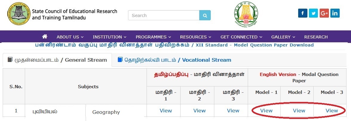
Download Model Question Paper :
Model – 1 :
https://www.pdfquestion.in/uploads/pdf2019/34088-Geo1.pdf
Model – 2 :
https://www.pdfquestion.in/uploads/pdf2019/34088-Geo2.pdf
Model – 3 :
https://www.pdfquestion.in/uploads/pdf2019/34088-Geo3.pdf
6. In which agriculture type, the products are stored close to the fields?
a) Intensive agriculture
b) Subsistence
c) Commercial agriculture
d) Extensive agriculture.
7 The economic activity that obtains its resources directly from the nature is
a) Primary Industries
b) Secondary Industries
c) Tertiary Industries
d) Quarternary Industries
8. An industry obtains its raw materials from another industry is referred to as.
a) Input Linkage
b)Output Linkage
c) Strong Linkage
d) Weak Linkage
9. The trade between the countries of the world is
a) Rural trade
b) Bilateraltrade
c) International trade
d) Local trade
10. The Quality and quantity of the commodities produced in a country depends on
a) Population growth
b) Technological development
c) Social growth
d) Cultural development
11. T.G.V train has been operated between the cities.
a) London- Manchester
b) Paris – Lyons
c) Delhi – Mumbai
d) Newyork – LosAngels
12. is useful for travelling long distance in a short while.
a) Aeroplane
b) Helicopter
c) Ships
d) Buses
13 Aerial photographs were taken for the first time from.
a) Aeroplane
b) Balloon
c) Mountain
d) Satellite
14. The river in dispute between Brazil and Argentina is
a) Laplata
b) Orinaco
c) Missisipi Missouri
d) Rhine
15. NDVI is
a) Field level data
b) Secondary data
c) Primary data
d) Satellite data
PART II
Answer any six questions in which question No.20 is compulsory : 6×2=12
16. What is Necton?
17. What are the reasons for uneven distribution of population?
18. Define Site.
19. What is weak Linkage?
20. What is Bilateral Trade?
21. What is Transport Network?
22. What are the two crisis of fresh water in the developing countries?
23. What do you mean by Remote Sensing platform?
24. What is Rainwater harvesting?
PART III
Answer any six questions in which Question no. 25 is compulsory : 6×3=18
25. Write a note on marshy land.
26. How many divisions can the working potential be classified in to on the basis of age?
27. What is meant by industrial region? Explain with examples.
28. Describe ASEAN.
29. Describe the Sea Tunnel ways.
30. Write about the Sun Synchronous Satellite.
31. In what ways water ‘ethics’ could be practised?
32. Explain Desertification with examples.
33. Describe Inter-State River Linkages.
PART – IV
Answer all the Questions. 5×5=25
34. Describe Tropical Biome.
(or)
Write in detail about Malthus’s population theory.
35. Discuss the progressive and regressive age sex Pyramids.
(Or)
Explain the types of Rural Settlement.
36. Discuss the factors of industrial locations
(Or)
Classify the type of trade geographically.
37. Water is a valuable resource – Explain.
(Or)
Describe the impacts of floods.
38. On the outline map of the world, mark the world’s important deserts and describe briefly.
(Or)
Mark the industrial regions on the world map.